

Appalachian Trail Travel Guide - Free Web & App
Your ultimate guide to Appalachian Trail. Discover top landmarks, proposed trips, and local tips. Free on the web or via the Evendo companion app.


Appalachian Trail in New Jersey crosses Kittatinny Ridge, High Point and Delaware Water Gap, offering forest hikes, shelters and broad views.
A Long-Distance Trail Through Ridge and Forest
The Appalachian Trail in New Jersey is a comparatively compact but varied section of the 2,190-mile footpath linking Springer Mountain in Georgia with Mount Katahdin in Maine. It runs for roughly 70 miles across the north-western part of the state, entering near the Delaware Water Gap and continuing north towards the New York boundary. Much of the route follows the Kittatinny Ridge, a long, elevated landform shaped by ancient geological forces, with hardwood forest, open farmland, wetlands and rocky viewpoints creating a changing walking experience.Read more about Appalachian Trail
From the Delaware Water Gap to High Point
A Trail for Day Walks and Through-Hikes
When is the best time to visit Appalachian Trail?
Best: June, August–September · 22–27°C| Month | High (°C) | Rainfall (mm) |
|---|---|---|
| January | 4 | 84 |
| February | 5 | 76 |
| March | 10 | 94 |
| April | 16 | 94 |
| May | 21 | 101 |
| June (best) | 26 | 104 |
| July | 28 | 104 |
| August (best) | 27 | 104 |
| September (best) | 22 | 95 |
| October | 16 | 88 |
| November | 10 | 96 |
| December | 5 | 93 |
Getting to and around Appalachian Trail
How to get there
Transportation
Best attractions in Appalachian Trail
The New Jersey Appalachian Trail offers a chain of landscapes rather than a single attraction. At the southern end, the Delaware Water Gap provides a dramatic river crossing through the Kittatinny Ridge, with access to nearby trails and the wooded setting of Worthington State Forest. The route then climbs and descends through ridge forest, farmland and open clearings before reaching High Point State Park, where the state’s highest elevation and broad northern views form a natural focus. Stokes State Forest contributes quiet woodland, lakes and wetland scenery, while the northern section approaches the larger forest and lowland landscapes of Wawayanda State Park. Shorter walks can be planned around road crossings and established access points, whereas backpackers can link shelters and campsites where regulations permit. The trail’s appeal lies in these transitions between river, ridge, forest and rural settlement, with seasonal foliage, birds and changing light adding variety without requiring a continuous through-hike.
-
State park
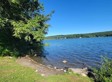
Swartswood State Park
Experience the tranquility of nature at Swartswood State Park in New Jersey, where adventure meets serene landscapes in a breathtaking outdoor retreat.
Best landmarks in Appalachian Trail
The Delaware Water Gap is the most prominent natural landmark on the New Jersey section, where the Delaware River passes through the Kittatinny Ridge and separates New Jersey from Pennsylvania. Kittatinny Ridge itself is the route’s defining geological and visual feature, producing long wooded elevations and occasional open outlooks. High Point, New Jersey’s highest natural elevation, is marked within High Point State Park and forms a key reference point for the state’s northern uplands. The Appalachian Trail’s shelters, white blazes and historic route alignment are cultural landmarks of long-distance hiking rather than monumental architecture. Around the trail, lakes, wetlands and forested valleys in Stokes and Wawayanda state parks show the contrasting environments preserved within the wider corridor. These features are managed landscapes as well as scenic sites, and their significance depends on the relationship between geology, water, woodland recovery and public conservation.
-
State park
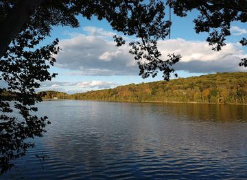
Kittatinny Valley State Park
Explore the breathtaking landscapes and diverse wildlife of Kittatinny Valley State Park, a premier natural retreat in New Jersey.
Explore Appalachian Trail on the map
Plan your trip on one map. See where the top attractions, landmarks, restaurants and hotels are, and book hotels and experiences in a few clicks.
Best hotels in Appalachian Trail
Best restaurants in Appalachian Trail
There is no restaurant district along the Appalachian Trail itself, and hikers should not expect food service at shelters or remote trail crossings. Dining is concentrated in nearby towns and roadside communities, including the wider areas around Delaware Water Gap, Blairstown, Branchville, Sussex and Vernon, with options varying from cafés and diners to pubs, takeaways and family restaurants. Larger settlements provide the most dependable choice for resupply, while convenience shops and petrol stations can be useful for basic provisions where available. The surrounding region reflects north-western New Jersey’s rural character, with farm-produced goods, seasonal fruit and vegetables, baked items and locally made products appearing through farm shops and community markets. Backpackers should carry food for sections without reliable access and check current opening arrangements rather than assuming that a rural establishment will be open when a hike finishes.
-
Cheesesteaks
Fat Daddy's Cheesesteaks
Discover mouthwatering cheesesteaks at Fat Daddy's in Lafayette, NJ – where quality meets affordability in every bite!

Get your free copy of our complete guide to Appalachian Trail, delivered straight to you.
Everything on this page, from attractions and restaurants to essentials and local phrases, in one PDF you can read offline, print or share.
Already have an account? Sign in
Your Appalachian Trail guide is ready.
We'll send it to · Not you? Sign out

Getting your guide ready…
We are putting together a fresh copy of the Appalachian Trail guide. This can take up to a minute.
This can take a few moments. If your browser asks, choose Allow so the download can start. You'll find the guide in your Downloads folder.
Nothing happened? Download it again
Sorry, the guide is taking longer than usual. Please try again in a minute, or get it by email instead.
Appalachian Trail essentials
Currency and Payment
Safety
Emergency Situations
Do's and Don'ts
Local Tips
From Eve
Local phrases worth knowing
You don't need to get them perfect. A few words go a long way, and locals appreciate the effort.
Basics
| English | Local | Say it |
|---|---|---|
| Hello | Howdy | [haw-dee] |
| Goodbye | See ya | [see yuh] |
| Yes | Yup | [yuhp] |
| No | Nah | [nuh] |
| Please/You're welcome | Please/No problem | [pleez/no prob-lem] |
| Thank you | Thank ya | [thank yuh] |
| Excuse me/Sorry | Pardon me/My bad | [par-dun me/my bad] |
| How are you? | Howdy | [haw-dee] |
| Fine. And you? | Doin' well. And you? | [doin' well. and yuh?] |
| Do you speak English? | Ya speak English? | [yah speak ing-glish?] |
| I don't understand | I ain't catchin' ya | [I aint catch-in yuh] |
Eating & Drinking
| English | Local | Say it |
|---|---|---|
| I'd like to see the menu, please | I reckon I'll take a look at the menu | [I reckon I'll take a look at the menu] |
| I don't eat meat | I ain't no meat-eater | [I aint no meat-eater] |
| Cheers! | Bottoms up! | [bot-ums up] |
| I would like to pay, please | I reckon I'll settle up now, please | [I reckon I'll settle up now, please] |
Emergencies
| English | Local | Say it |
|---|---|---|
| Help! | Help! | [Help!] |
| Go away! | Git out! | [git out!] |
| Call the Police! | Ring the Sheriff! | [ring the sheriff!] |
| Call a doctor! | Fetch a doc! | [fetch a doc!] |
| I'm lost | I'm turned around | [I'm turned around] |
| I'm ill | I'm feelin' poorly | [I'm feelin' poorly] |
Shopping
| English | Local | Say it |
|---|---|---|
| I'd like to buy... | I reckon I'll grab... | [I reckon I'll grab...] |
| I'm just looking | Just browsin' | [just browsin'] |
| How much is it? | What's the damage? | [whats the dam-age] |
| That's too expensive | That's steep | [that's steep] |
| Can you lower the price? | Can ya come down on the price? | [can ya come down on the price?] |
Time & Numbers
| English | Local | Say it |
|---|---|---|
| What time is it? | What's the hour? | [whats the hour?] |
| It's one o'clock | It's one | [It's one] |
| Half past (10) | Ten-thirty | [ten-thur-tee] |
| Morning | Mornin' | [mornin'] |
| Afternoon | Afternoon | [Afternoon] |
| Evening | Evenin' | [evenin'] |
| Yesterday | Yest'day | [yest'day] |
| Today | Today | [Today] |
| Tomorrow | Tomorrer | [tom-or-er] |
| 1 | One | [One] |
| 2 | Two | [Two] |
| 3 | Three | [Three] |
| 4 | Four | [Four] |
| 5 | Five | [Five] |
| 6 | Six | [Six] |
| 7 | Seven | [Seven] |
| 8 | Eight | [Eight] |
| 9 | Nine | [Nine] |
| 10 | Ten | [Ten] |
Transport & Directions
| English | Local | Say it |
|---|---|---|
| Where's a/the...? | Where's... at? | [Where's... at?] |
| What's the address? | What's the street? | [What's the street?] |
| Can you show me (on the map)? | Can ya point it out (on the map)? | [Can ya point it out (on the map)?] |
| When's the next (bus)? | When's the next bus? | [When's the next bus?] |
| A ticket (to ....) | A pass (to ....) | [A pass (to ....)] |
History of Appalachian Trail
Geology of the Kittatinny Ridge
The New Jersey section of the Appalachian Trail follows landscapes shaped over immense geological timescales. The Kittatinny Ridge is associated with resistant Silurian quartzite, while the surrounding valleys contain softer rocks that have eroded more readily. This contrast created the elevated ridge, forested slopes and open viewpoints characteristic of the route. The Delaware Water Gap formed where the Delaware River cuts through the ridge, providing one of the state’s defining natural gateways. These geological relationships explain why the trail repeatedly climbs to exposed crestlines before descending towards wetlands, valleys and river country.
Indigenous Homelands and Colonial Change
Before colonial settlement, the region was part of the homeland of Lenape communities, whose lives were connected to the Delaware River, inland forests and seasonal resources. European settlement brought farms, mills, roads and changing patterns of land ownership. The ridge itself remained less intensively cultivated than the valleys, but surrounding forests were cut for fuel, construction and charcoal, while agricultural communities developed around more accessible lowlands. Place names and surviving rural landscapes reflect this layered history, although much of the trail passes through land whose present appearance has been substantially shaped by later conservation.
From Working Landscape to Protected Land
During the nineteenth and early twentieth centuries, north-western New Jersey combined farming with timber use, small industries and transport routes linked to regional markets. Some areas later experienced forest recovery as marginal farms were abandoned and land-use patterns changed. Public acquisition and conservation created the protected landscapes through which the trail now passes, including High Point State Park, Stokes State Forest, Wawayanda State Park and other managed lands. These designations preserve habitats, water catchments, historic rural settings and recreational access, while requiring visitors to respect differing rules across adjoining properties.
The Appalachian Trail Era
The Appalachian Trail was conceived in the 1920s as a continuous footpath through the eastern mountains and was substantially completed in 1937. Its New Jersey route developed through cooperation between trail advocates, land managers and volunteers, linking existing protected landscapes and rural roads into a long-distance corridor. The trail has since become both a through-hiking route and a resource for local day walkers. In New Jersey, maintenance, relocations, shelter management and conservation depend heavily on volunteer effort and coordination with public land agencies, while growing recreational use has made responsible access increasingly important.
Appalachian Trail in Photos
Browse through our photo collection highlighting the charm and character of the destination.
Neighbouring destination travel guides
The closest destinations to Appalachian Trail, if you have time for more than one.
-

-

-

-

-


Swipe for more destinations
Explore more

Explore more of North Jersey
Explore North Jersey for Hudson River cities, immigrant foodways, Revolutionary history, industrial heritage and forested highland landscapes.
Explore North Jersey
Explore more of New Jersey
Discover New Jersey: From vibrant cities and historic towns to scenic beaches and lush parks, the Garden State offers a rich blend of culture, nature, and adventure.
Explore New Jersey